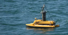
GIS and Mapping GIS and Mapping are powerful tools for visualizing and analyzing spatial data. Get a Quote Topographic survey Topographic surveys create a detailed map of the Earth's surface. get a quote Contour Survey Contour surveys map the shape of the Earth's surface using lines of equal elevation. get a quote DGPS Survey It corrects for errors in GPS measurements, providing more accurate results. get a quote Drone Survey A cost-effective and efficient way to collect aerial data. Get a Quote GPR Survey A non-destructive way to image the subsurface. get a quote Landscape Survey A systematic study of the natural & man-made features of an area. get a quote Levelling Survey A method of determining the relative heights of points on the Earth's surface. get a quote LiDAR Survey A remote sensing technology that uses laser pulses to create 3D models of the Earth's surface. Get a Quote Bathymetric Survey A method of measuring the depth of water bodies and mapping the underwater features of the seabed. get a quote Pipeline Survey A method of locating, mapping, and inspecting pipelines. get a quote